
Discover Walvis Bay with it’s rich history and many peculiarities.
Walvis Bay is situated in an unlikely spot and the story of it’s settlement is very interesting. This private half day tour of Walvis Bay is quite popular among cruise liner passengers with a little time to kill, as well as tourists and other new arrivals to Walvis Bay.
Your private tour guide is a local with plenty of knowledge of this unique town. You will be shown features that makes Walvis Bay singular, and will have a new respect for the enterprising spirit of it’s founders then and inhabitants now. Continue reading for some details of the tour!


Your route through the town is determined by weather on the day, how you feel and what sort of things you are interested in. Your private guide will chat with you and optimize the tour for you. Mornings are usually the best time of day, as most afternoons are windy with a fresh Southwesterly wind. Continue reading for a just a few of the main attractions to Walvis Bay.
Youtube Video about Walvis Bay
The Lagoon

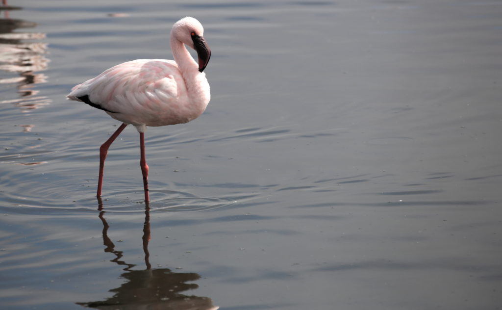
The Lagoon of Walvis Bay is situated in the wetlands of Walvis Bay, a declared RAMSAR nature reserve site. Teeming with wildlife it makes the most beautiful centerpiece of this interesting coastal town. On clear mornings the combination of perfect early morning light and glassy seas make an ideal setting for taking pictures of our local wildlife. Flamingo and Pelican is quite common here. The wildlife can be viewed from any of the many ample parking spaces along the lagoon.
During winter times, the mornings can be cold and foggy, adding a somber atmosphere to photos of our town. On foggy days, the fog clears early almost every day. Usually a bit later in the winter than in the summer. Around the Lagoon there is a 2 km walkway that is used by morning joggers, along with “The Raft” and the “Millionaires Mile” that are situated along the lagoon. A few boutique lodges are situated in between the mostly residential buildings with a view of the lagoon. A grassy park with tall palm trees form a buffer between the lagoon and the millionaires.
The Waterfront
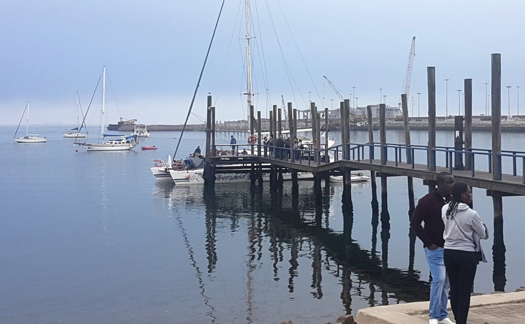
Wedged in between the lagoon and the only deep water port in Namibia is the waterfront. A tourist hot spot with various small curio shops and restaurants. With adequate parking this is a popular meeting point for tourism activities like boat cruises or just browsing around. It is very scenic with all the yachts and yacht club that has the only beach in Walvis Bay. All the restaurants here have stunning food and open air for those nice days, and serve beer all day long.
The area surrounding Walvis Bay
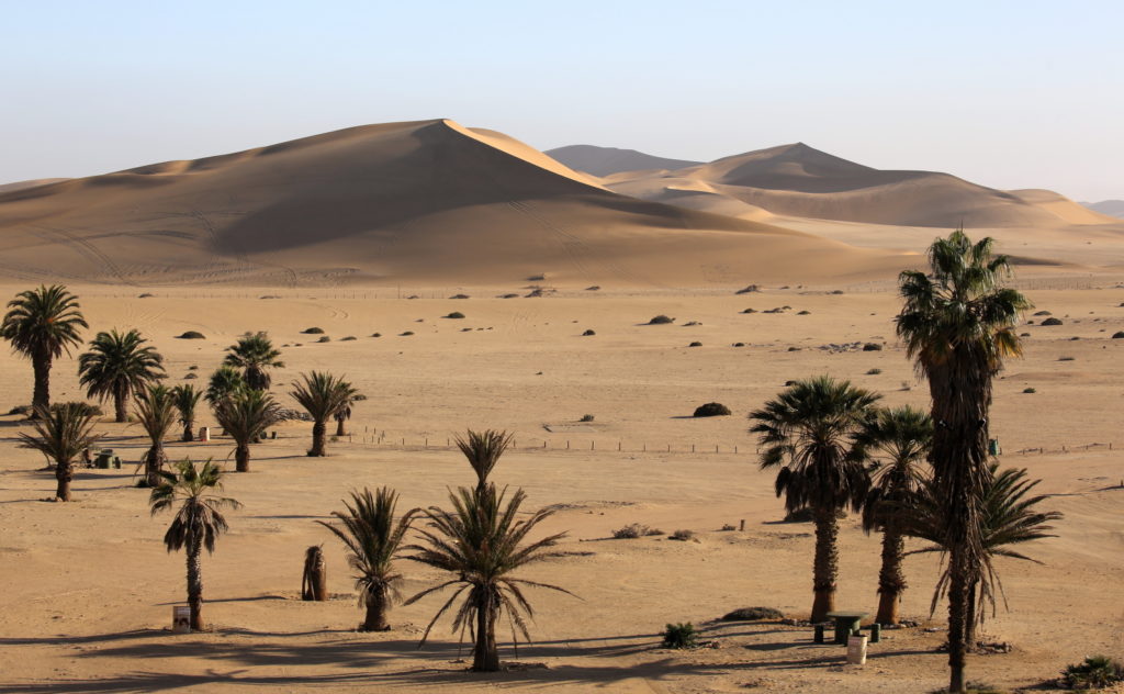
The landscape surrounding Walvis Bay has a pure, stark beauty to it. Surely it must have seemed very forbidding to the early explorers that colonized the coast of Namibia. The perfect place to get an appreciation for this landscape is Dune 7. Acclaimed as the top attraction at the coast, according to TripAdvisor. The picnic area was constructed by the municipality of Walvis Bay during colonial times and is being maintained by Dune 7 Adventures today. This area is being slowly covered by the advancing dune. You are free to climb the dune if you want the best views, and your guide will gladly join you because we need the exercise!
Bird Paradise
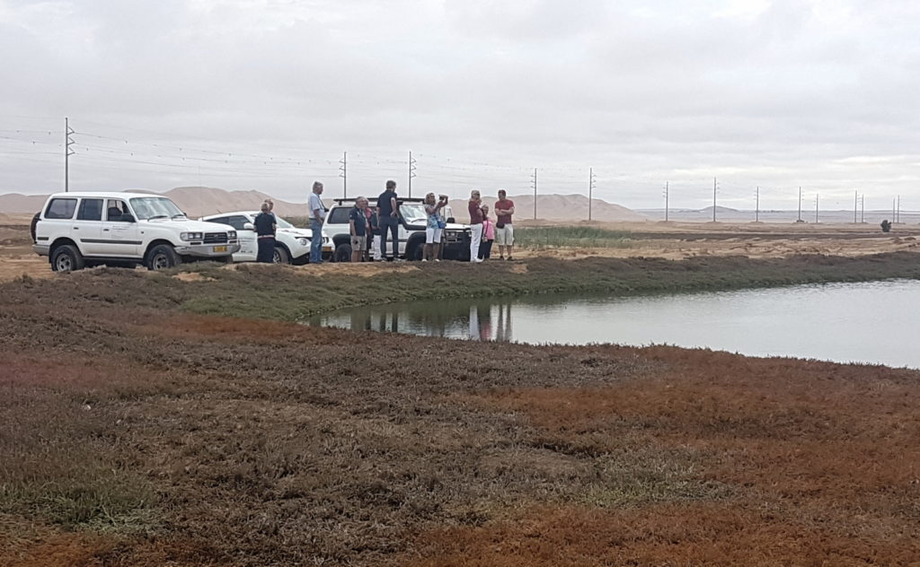
The bird paradise situated East of Walvis Bay is the area where the waste water of Walvis Bay is dumped. All the solids are removed before being dumped, and this mostly fresh water lakes is a big attraction for Flamingo and other bird species. The area is rich with walking trails and is quite verdant. The bird paradise is visible from the road from Walvis Bay to the air port and Dune 7.
Narraville

Historically designated the neighborhood for people of mixed race by the previous government this suburb of Walvis Bay is clean and tidy. All the houses are of cement construction, and there are some very nice houses indeed. You will be taken on a slow drive past the community center, around the municipal buildings and through the residential areas of this suburb.
On the route through this neighborhood you are free to take photos of anything you see, and also to stop the vehicle if you want to take pictures or talk to the locals. If you want to meet any of the persons on the street, they are usually very friendly. On the edges of this suburb the contrast between the sand dunes and the development is quite spectacular.
Bird Island
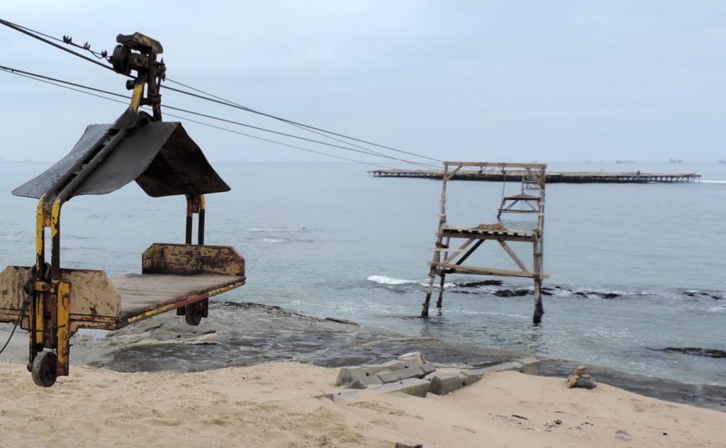
Situated a little bit North of Walvis Bay, the bird island is a curious man made structure. This structure was conceived and constructed by Adolf Winter, a German immigrant who immigrated to South West Africa (Now Namibia) in 1912. The initial construction started in 1930, up to 1937 where the final size of the island was 17,000 square meters.
The whole purpose of this island is to provide a safe place for marine birds to roost. The guano from this island is collected once a year, and sold as high quality fertilizer. For a much more in-depth read, follow this link.
Kuisebmond

Driving through the Kuisbmond the atmosphere is definitely more “Africa” than the rest of Walvis Bay.
The suburb of Kuisebmond is named after the Kuiseb river, and the fact that the river used to flood this area before the flow of the river was changed late in the 1900’s. During the development of Walvis Bay, Kuisebmond was designated to be the neighborhood for black people by the South African government. During this time a lot of manual labor arrived from little villages and shanty houses were erected. There is still a sizable shanty town in Kuisebmond, despite our government and municipality’s housing projects to get people living in proper housing.
MOTH club
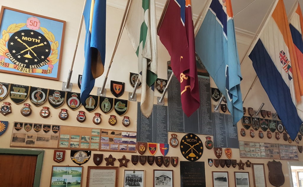
The MOTH (Military Old Timers Hall) is situated in Walvis Bay, and is a treasure trove of Military and other Walvis Bay History. Mostly a bar these days, you can have some liquid refreshment and use their excellent facilities.
Encroaching Desert
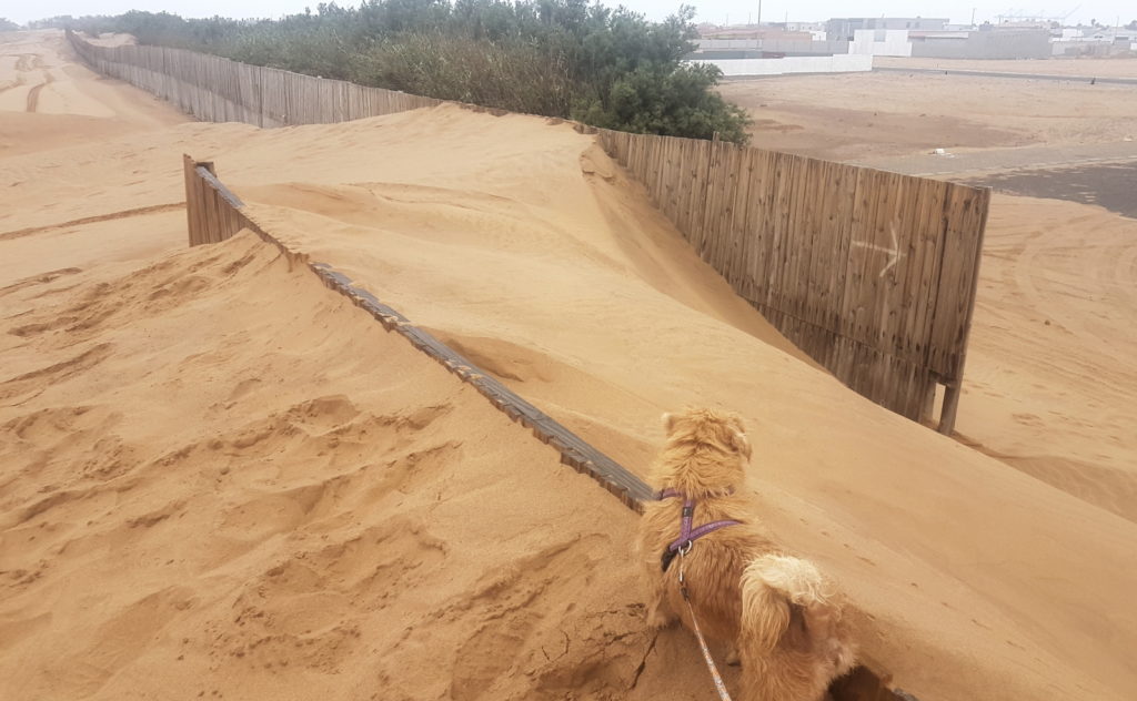
The desert has not stopped it’s onslaught of Walvis Bay, and never will. It is a testament to the dogged tenacity of the inhabitants to keep the desert at bay. At the South edge of the town is where you find the triple defenses of Walvis Bay against the desert. A wooden fence marks the end of town, and stops the sand. This sand is cleared once a month by the Municipality. Behind the fence there is a row of reeds and trees to break the wind speed and provide a little protection.
Walvis Bay Salt Holdings

Walvis Bay Salt Holdings is the latest company that runs the solar salt plant South of Walvis Bay. This location has been an attraction for tourists from before the Namibian independence. Established in 1964, this facility produces 700,000 tonnes of high quality salt every year. Of particular interest for this tour is the pink water lakes that are quite prominent. The lakes with a lower concentration of salt are home to many bird species. On clear days one can see the dune sea South of the Kuiseb river, Rooikop (Our airport) as well as Dune 7 from the top of the dune next to the processing facility.
Details
- Duration: 4 hours (at least, longer on request)
- Activity level: Easy/relaxed
Inclusions
- Bottled Water
- Free pickup in Walvis Bay, including harbor
- Private, air conditioned transport
- Local guide
Pickup Services
You will only get the best service at Awesome Chapters:
- Time:
- Your pickup time is determined by you during the booking process.
- Free in Walvis Bay:
- Your adventure starts at your accommodation because your private tour guide will pick you up with the tour vehicle.
- Cruise liners:
- If you are arriving on a cruise liner, you will be collected you from the ship, inside the harbor gates for no extra charge.
- Transfers available:
- Should you wish to be picked up outside of the Walvis Bay area, just cover our fuel costs with a small transfer fee.
Booking – Email
If you are interested in this tour, but you would like to have a discussion with us first, you are welcome to contact us for some human interaction. The booking will be made for you with the information from our chat. We love hearing from you, so even if you do not want to book the tour, and just want some more information, you are still welcome to drop us an email.
Alternatively, drop us a line on the contact form below and we will come back to you!
A little pre-history of Walvis Bay
Walvis Bay was officially proclaimed in 1878, but it’s history starts a long time before that. The first record is when Bartholomeu Diaz discovered the Cape of Good hope and subsequently also Walvis Bay on 8 December 1487. In the next couple of hundred years there was not too much interest in Walvis Bay, primarily due to the inhospitable nature of the coast. It’s called Skeleton Coast, after all. As Cape Town was being settled, the Dutch also did not consider Walvis Bay important enough to annex it, and the harbor was mostly used by pirates and slave traders.
In 1784 American whalers began to use the bay to wait for whales, and pretty soon other whalers were using the harbor as well. You can still see whale bones scattered around Walvis Bay even today. All this action, as well as rumors about the mineral wealth of the country North of the Orange river spurred the Dutch in Cape Town to occupy “Walfish Bay” in 1793.
When France invaded Holland a couple of years later, England feared that the French would also gain control of the profitable trade rout to the Far East. In 1795 England occupied the Cape, as well as Walvis Bay. This occupation, as well as the one by the Dutch in 1793 was never officiated. The whaling industry, as well as trade between the ships and Topnaar people of the Kuiseb river continued for a few years, and then was abandoned.
In 1840, when Germany increased their presence in what is now known as Namibia, Britain was forced to re-assert it’s stake in Walvis Bay, and on 12 March 1878 Captain Dreyer annexed Walvis Bay officially in the name of Britain. Due to logistical problems in administering Walvis Bay from Britain, control was handed over to Cape Town in the subsequent years, and Walvis Bay was part of the Cape Colony, and, so was part of South Africa in 1910.
When Namibia gained independence from South Africa in 1990, Walvis Bay remained as part of South Africa, as it has never been a part of the German colony. Later, in 1993, Walvis Bay was handed over to Namibia, and became part of it.
Water supply
How does one start a town in a desert? It is quite an interesting story as well.
The Kuiseb river flows very infrequently, with years passing between it flowing, so it did not count as a stable water supply. Sandfontein only delivered very brackish water that was used for washing only, and had to be carted over the dunes in drums. Fresh water was shipped from Cape Town every 5 weeks, and it was cheaper to drink beer than water. In 1988 a condensation plant was erected by the Government to provide some independence from Cape Town. The water produced by this plant was some of the most expensive water in the world.
Fortunately, due to the foresight of Captain R. C. Dreyer, when he annexed the area for Britain, there is a good water supply. Included in the area that was annexed is Rooibank, in the Kuiseb River. This area has strong underground water, and boreholes were sunk and connected to the town with a pipe over the dune sea. In those days it took 8 hours to reach Rooibank from Walvis Bay with an Ox wagon, where today it can be reached in less than an hour.
The water at Rooibank has it’s source in Khomas Hochland area, from where it is supplemented by tributaries. Near Rooibank and towards the coast, there are very deep layers of sand through which the water filters through towards the coast. It is from these underground reservoirs that the water is drawn. Until fairly recently this water source also supplied water to Swakopmund and the Uranium mines up the Swakop river. As the settlements grew, so did the demand for more fresh water.
A desalination plant was erected near Swakopmund by AREVA, mainly to supply water for mining operations near Trekkopje, but excess is sold to the municipalities to lighten the load on the Kuiseb river. You can see the pipes running over the desert next to some roads.